

REVIEW · BISCAYNE BAY CRUISES
Miami Cityscape Boat Tour – Waterfront Views on Biscayne Bay
A skyline from the water feels different. This Miami Cityscape Boat Tour takes you across Biscayne Bay with views of Downtown Miami, the islands, and the famous homes along the way, plus a guide who turns the scenery into a story of how the city changed over time.
I especially like the spectacular skyline views and the narration that helps you connect the landmarks, bridges, and island names to what Miami became.
One consideration: it’s built for value, so you may feel a bit of pressure around tips, and you’ll want to plan ahead for anything you want to drink or snack because food isn’t included.
In This Review
- Key highlights at a glance
- Biscayne Bay skyline views, without a full day schedule
- What I like most: the views and the story
- One possible drawback to keep in mind
- Getting on board: Bayside Marketplace to Pier 5 check-in
- Tickets are mobile, so keep your phone ready
- How early should you show up?
- Port of Miami passes: cruise ships and cargo in one sweep
- Why this port angle is valuable
- Downtown Miami skyline: what to watch for on the water
- Practical photo tip
- Watson Island: the story behind the island neighborhoods
- What you’ll likely notice
- The Venetian Causeway and the Venetian Islands chain
- Names you can actually remember
- A key detail: Flagler Memorial Island and the monument
- MacArthur Causeway: the main connection to South Beach
- Why you should pay attention here
- San Marco, Di Lido, Hibiscus, Palm, and Star: the “famous homes” style views
- What makes this section special
- Fisher Island and the big-water lifestyle feel
- Why it works on a boat tour
- Miami Beach Marina and Government Cut area: where the water action is
- Cargo plus cruising plus skyline: how the route balances photo and meaning
- Duration, group size, and who this tour fits best
- You’ll probably enjoy it if
- You might want to skip or adjust if
- Price and value check: is $27.99 worth it?
- Should you book the Miami Cityscape Boat Tour?
- FAQ
- Where does the tour start?
- Where do I check in at the pier?
- How long is the boat tour?
- How much does it cost?
- What is included in the ticket?
- What is not included?
- Is a mobile ticket used?
- Is the tour family-friendly?
- Is alcohol allowed?
- Is it free to cancel?
Key highlights at a glance
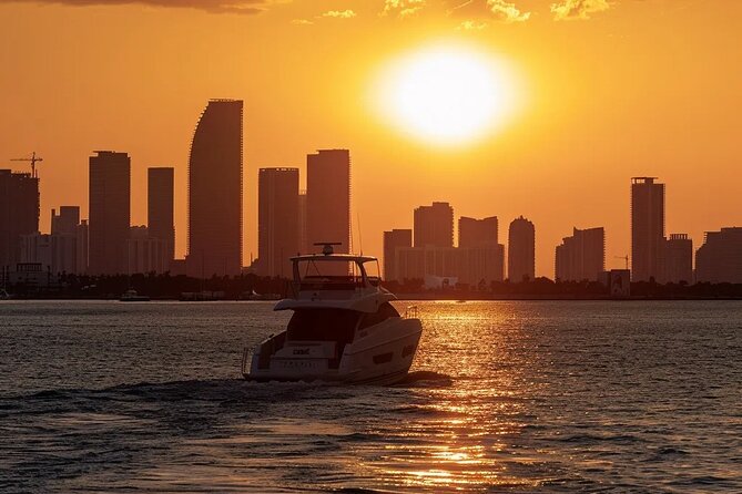
- Bayside Marketplace pick-up area: 401 Biscayne Blvd, then head to Pier 5, slips 21–23 for check-in at the Bayride Tours window.
- Downtown skyline + cruise-port views: you’ll pass the Port of Miami and the big liners that sail from here.
- Artificial island route: Watson Island, the Venetian Islands, and the causeways that connect Miami to Miami Beach.
- Landmarks with real names: Henry Flagler’s memorial island and the obelisk are part of the route’s photo stops.
- Straightforward 1.5-hour timing: enough time for photos and facts without turning into your whole day.
- Small-ish boat experience: maximum 120 travelers, with safety gear included.
More laps of Biscayne Bay, set side by side
- Miami Combo: City Tour, Biscayne Bay Cruise and Everglades Airboat Ride
★ 3.5 · 2,487 reviews - Miami Biscayne Bay rich and famous Sightseeing Boat Tour
★ 4.5 · 1,998 reviews - Miami: Everglades Experience, Bay Cruise & Open-Top Bus Tour
★ 4.0 · 1,918 reviews - Miami Skyline Views and Biscayne Bay Cruise
★ 4.5 · 905 reviews
Biscayne Bay skyline views, without a full day schedule
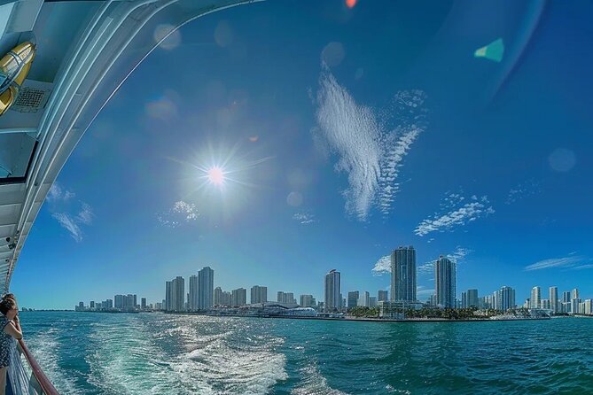
If you only have a slice of time in Miami, this is a smart way to spend it. At roughly 1 hour 30 minutes, you get moving views of Downtown’s skyscrapers and the island neighborhoods spread across Biscayne Bay. It’s not about doing a complicated itinerary. It’s about seeing the city from the water and getting context while you go.
The tour also leans into what Miami looks like at its most photogenic: the skyline in one direction, big-water waterfronts in the other, and then the long run of island communities that make the bay feel like a set of connected worlds.
What I like most: the views and the story
The skyline shots matter, but the guide angle matters too. You’re not just staring out at buildings. You’re getting explanations that help the scenery make sense—like how the islands formed and why the causeways and bridges are such a big deal here.
And based on the feedback, the narration quality is a real strength. People specifically praised how well the guide talked and how the route includes stops where you can actually see what they’re describing.
One possible drawback to keep in mind
This tour is value-priced, and that can show up in how staff interact at the end. Some people felt the crew wasn’t as friendly as they expected, and that tips were pushed a bit. If you’re not comfortable with that kind of wrap-up sales energy, just decide your plan for tips early so it doesn’t spoil the mood.
Getting on board: Bayside Marketplace to Pier 5 check-in
Start at Bayside Marketplace, at 401 Biscayne Blvd, Miami, FL 33132. When you arrive, the key is knowing exactly where to go next: head toward Pier 5, slips 21–23, which are located behind the Victoria Secret area. Then check in at the Bayride Tours window on the north side of the pier.
This matters because Bayside can feel busy. The clearer you are on the pier number and where slips 21–23 are, the smoother everything feels once you show up.
Before you lock in this Miami trip, weigh these up too:


Tickets are mobile, so keep your phone ready
You’ll use a mobile ticket, and confirmation comes at booking. That’s convenient because you don’t need to hunt for printed passes right before boarding.
How early should you show up?
The info provided doesn’t give a strict time, but if you want a calm start, I’d treat this like any popular waterfront tour: arrive early enough to find the correct check-in window without rushing.
Port of Miami passes: cruise ships and cargo in one sweep
One of the most interesting parts of the route is that you don’t only see postcard Miami. You also see how Miami functions as a working port.
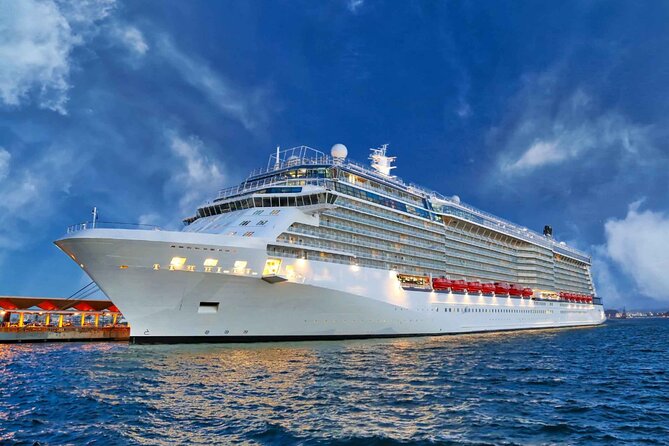
You’ll go through the passenger area of the Port of Miami, where major cruise lines set sail. The tour description specifically calls out Virgin Cruise Lines and Royal Caribbean. That gives you a front-row perspective on how this city connects to the wider world.
Then later, you also get a look at the cargo section of the Port of Miami, which is a reminder that big ships aren’t only for vacations. They’re part of Miami’s global trade position.
Why this port angle is valuable
Many city tours focus only on skyline glamour. Here, the working-port views add a layer of realism. You see the city as a place where leisure and industry share the same waterway.
Downtown Miami skyline: what to watch for on the water
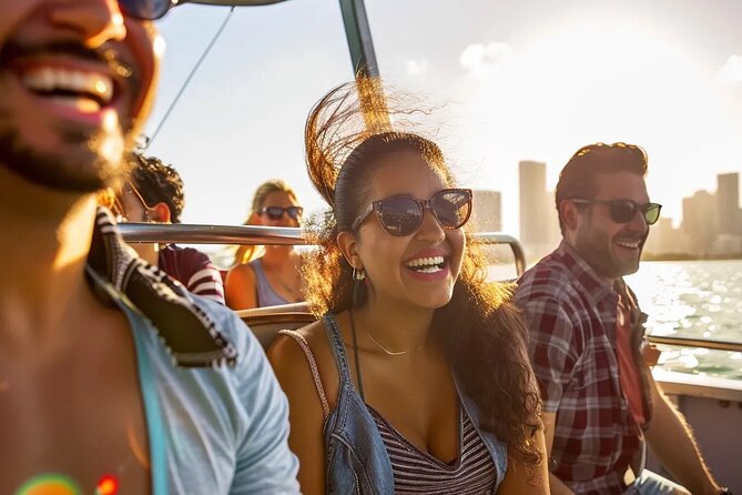
Once you’re past the port area, the tour turns toward what most people came for: architecture and skyscrapers along the downtown waterfront.
Even if you don’t care about every building name, you can still get a lot from this section. It’s the kind of moving vantage point that shows you how Miami’s skyline sits against the bay, and how the waterfront shapes the city’s identity.
Practical photo tip
Bring sunglasses and keep your phone ready, but also remember that you’ll be moving. The best shots are usually the ones where you can pause for a second during slower passes—so stay aware of when the guide starts pointing out specific features.
Watson Island: the story behind the island neighborhoods

A highlight for many people is seeing Watson Island, a man-made island in Biscayne Bay. The tour description emphasizes its location east of downtown and its connection through major routes like the MacArthur Causeway.
What makes this stop interesting is the background. The tour notes that Watson Island was deeded with restrictions about public or municipal use, then returned through similar restriction frameworks. It’s also part of the kind of Miami puzzle where land creation, city planning, and policy all intersect.
What you’ll likely notice
From the water, you’ll be watching the shoreline and home neighborhoods slip by. The guide’s context is what helps turn that into more than just a row of houses—it becomes a lesson in how Miami expanded and reshaped itself.
The Venetian Causeway and the Venetian Islands chain
Next comes the area most associated with Miami’s artificial-island look: the Venetian Causeway and the Venetian Islands.
The causeway crosses Biscayne Bay between Miami and Miami Beach. The description also explains that the man-made islands and non-bridge portions were created using materials from dredging the bay. That’s a big deal in Miami because so much of what you see is tied to how the bay was reshaped.
Names you can actually remember
The tour outlines the Venetian Islands from west to east:
- Biscayne Island
- San Marco Island
- San Marino Island
- Di Lido Island
- Rivo Alto Island
- Belle Isle
There’s even a reference to Flagler Monument Island as part of the island group, described as an uninhabited picnic island with an obelisk monument tied to Henry Flagler.
If you like tours where you leave with a mental map, this stop is built for that. You can piece together the chain and connect it to the causeways that link the mainland to Miami Beach.
A key detail: Flagler Memorial Island and the monument
One of the most specific landmarks mentioned is Flagler Memorial Island, where there’s a 110-foot obelisk and allegorical sculptures at the base. This is tied to Henry M. Flagler, a pioneer associated with Miami development, and the monument was built with commissioning details included in the tour description.
Even if monuments aren’t your thing, it’s a strong photo moment because the structure is easy to spot from the water.
MacArthur Causeway: the main connection to South Beach

The route also includes the General Douglas MacArthur Causeway, described as a six-lane connection between Downtown Miami and South Beach via Biscayne Bay.
This matters because it frames the bay as a transportation corridor, not just scenery. The tour also notes that it’s the singular roadway connecting the mainland and beaches to waterfront areas including Watson Island, plus other bay neighborhoods such as Palm Island, Hibiscus Island, and Star Island.
Why you should pay attention here
From a visitor standpoint, causeways are easy to ignore—until you’re looking at them from a boat. Then you see how the whole network guides where people live, where they commute, and how the city keeps growing along the water.
San Marco, Di Lido, Hibiscus, Palm, and Star: the “famous homes” style views
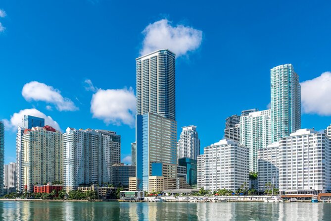
You’ll also pass several specific island neighborhoods, with descriptions that underline how exclusive and home-focused these areas are. The route calls out:
- San Marco Island: upscale houses and part of the Venetian Islands chain
- Di Lido Island: residential neighborhoods and part of the Venetian Causeway area
- Hibiscus Island: an exclusive residential neighborhood with high property values, connected by the MacArthur Causeway
- Palm Island: a residential neighborhood with high property values, described as accessible by land via the MacArthur Causeway
- Star Island: known for celebrity ownership in the past and a “star-studded” reputation
From the water, your experience here is pretty simple: look at the coastline, notice how the island layouts differ, and listen to the guide connect the names to the neighborhood vibe.
What makes this section special
This portion is where the tour seems to hit hardest for people who want the Miami glamour view. The feedback included compliments about the guide describing houses of famous people and passing by all the islands, so this is likely where the narration rhythm and viewing lines click best.
Fisher Island and the big-water lifestyle feel
The route also includes Fisher Island, described as a barrier-island location in Miami-Dade County. It’s noted that it’s accessible only by private boat, helicopter, or ferry, with no road or causeway connecting to it.
The description also adds a useful local profile detail: since 2015, Fisher Island has the highest per capita income of any place in the United States.
Why it works on a boat tour
Fisher Island is the kind of place that sounds grand. Seeing it from Biscayne Bay gives you a clearer sense of why it’s secluded and how it sits out in the water. It’s less about facts and more about the visual logic of an island that doesn’t plug into the mainland road network.
Miami Beach Marina and Government Cut area: where the water action is
There’s also a stop that references the Miami Beach Marina near Government Cut. The description highlights:
- deep water and no fixed bridges
- adjacency to South Beach access
- the nearby Art Deco District
- 400 boat slips, with slip hookups like fresh water and electricity mentioned
- capacity for vessels up to 250 feet
Even if you’re not docking a yacht, this is still useful context. It shows you what kind of boating infrastructure exists around this area and why the waterfront here feels like it’s built for serious marine traffic.
Cargo plus cruising plus skyline: how the route balances photo and meaning
A lot of Miami tours feel lopsided: either all skyline, or all neighborhoods. This one balances three modes:
- Glitz views: downtown skyline and island neighborhoods
- Real infrastructure: port passenger and cargo areas
- City-shaping geography: causeways and man-made islands built from bay dredging material
The result is a route that’s still easy—no transfers and no complicated timing—but feels more informative than a pure sightseeing loop.
Duration, group size, and who this tour fits best
At about 1.5 hours and with a maximum of 120 travelers, this is a workable option for many kinds of schedules. It’s also described as family-friendly and suitable for all ages.
You’ll probably enjoy it if
- you want a relaxing waterfront activity without committing your whole day
- you like skyline photos plus a guided explanation
- you’re curious about how Miami’s bayfront neighborhoods and causeways connect
You might want to skip or adjust if
- you hate anything that feels like a tip pitch
- you need a longer walking-style sightseeing experience with stops you can explore on foot
Price and value check: is $27.99 worth it?
The ticket price is $27.99 per person, and the tour runs about 1 hour 30 minutes. Included in the experience are scenic views, professional crews and staff, and safety gear and equipment. Drinks and food are available for purchase, and tips aren’t included.
Here’s how I’d judge value:
- If you want a guided, photo-friendly boat view of Downtown Miami and Biscayne Bay islands, this price sits in a reasonable zone for what you get: time on the water plus narration.
- If you’re trying to squeeze in multiple activities in one day, the short duration helps.
- If you’re expecting a full-service meal or drinks included, you’ll want to budget a little extra since purchases are on you.
Also note: there’s no hotel pickup. That’s not a problem if you’re already near Bayside Marketplace, but it matters if you’re farther out and relying on rides or transit planning.
Should you book the Miami Cityscape Boat Tour?
I’d book this if you want the easiest way to see Downtown Miami, Biscayne Bay, and the island neighborhoods in one guided outing, especially for the price point and the short time commitment. The standout strengths are the skyline views and the guide narration, which is exactly what makes a boat tour feel worth your time.
Skip it or be cautious if tips and end-of-tour sales energy can bug you. Also, if you need deep, stop-by-stop exploration on land, this won’t replace a full walking tour of Miami Beach or Downtown. Think of it as a high-value water perspective with good explanations—not a whole-day immersion.
FAQ
Where does the tour start?
It starts at Bayside Marketplace, 401 Biscayne Blvd, Miami, FL 33132.
Where do I check in at the pier?
Head to Pier 5, slips 21–23, behind the Victoria Secret area, and check in at the Bayride Tours window on the north side of the pier.
How long is the boat tour?
The duration is about 1 hour 30 minutes.
How much does it cost?
The price is $27.99 per person.
What is included in the ticket?
The ticket includes scenic views, professional crews and staff, and safety gear and equipment.
What is not included?
Food and drinks are for purchase, and tips/gratuities are not included. There is also no hotel pickup and drop-off.
Is a mobile ticket used?
Yes, you’ll use a mobile ticket.
Is the tour family-friendly?
Yes, it’s described as family-friendly and suitable for all ages.
Is alcohol allowed?
Alcoholic beverages are allowed for guests 21 and older.
Is it free to cancel?
The policy allows free cancellation up to 24 hours in advance for a full refund.
More Miami Trips We Have Reviewed
- Little Havana Food and Walking Tour in Miami
★ 5.0 · 8,882 reviews - Miami: Everglades National Park Airboat Tour & Wildlife Show
★ 4.5 · 7,296 reviews - Miami: Hop-on Hop-off Open-top Bus Tour and Optional Cruise
★ 4.1 · 3,077 reviews - 2 hrs Miami Private Boat Tour with Cooler, Ice, Bluetooth Stereo
★ 5.0 · 2,968 reviews - City Half Day Tour of Miami by Bus with Sightseeing Cruise
★ 3.5 · 2,747 reviews
More Tour Reviews in Miami
- Little Havana Food and Walking Tour in Miami
★ 5.0 · 8,882 reviews - From Miami: Everglades Airboat, Wildlife Show & Bus Transfer
★ 4.2 · 8,622 reviews - Miami: Biscayne Bay Millionaire’s Homes Sightseeing Cruise
★ 4.5 · 7,348 reviews - Miami: Everglades National Park Airboat Tour & Wildlife Show
★ 4.5 · 7,296 reviews - Miami: Hop-on Hop-off Open-top Bus Tour and Optional Cruise
★ 4.1 · 3,077 reviews
More Ways Around Biscayne Bay
- Miami: Biscayne Bay Millionaire’s Homes Sightseeing Cruise
★ 4.5 · 7,348 reviews - Miami Combo: City Tour, Biscayne Bay Cruise and Everglades Airboat Ride
★ 3.5 · 2,487 reviews - Miami Biscayne Bay rich and famous Sightseeing Boat Tour
★ 4.5 · 1,998 reviews - Miami: Everglades Experience, Bay Cruise & Open-Top Bus Tour
★ 4.0 · 1,918 reviews - Miami Skyline Views and Biscayne Bay Cruise
★ 4.5 · 905 reviews
Just Added: New Miami Reviews




Biscayne Bay Cruises, compared.
 ★ 4.5Biscayne Bay Millionaire’s Homes Sightseeing CruiseFrom $207,348 reviews
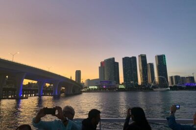 ★ 3.5Miami Combo: City Tour, Biscayne Bay Cruise and Everglades Airboat RideFrom $692,487 reviews
 ★ 4.1Half-Day Open-Top Bus Tour Plus Biscayne Bay CruiseFrom $512,420 reviews
 ★ 4.5Miami Biscayne Bay rich and famous Sightseeing Boat TourFrom $281,998 reviews
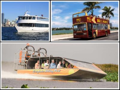 ★ 4.0Everglades Experience, Bay Cruise & Open-Top Bus TourFrom $801,918 reviews
 ★ 4.5Miami Skyline Views and Biscayne Bay CruiseFrom $35905 reviews
 ★ 4.0Biscayne Bay and Celebrity Island Homes Boat Tour 90 MinuteFrom $34486 reviews
 ★ 5.0Sail Biscayne Bay: An Intimate Eco-Adventure with SnorkelingFrom $129441 reviews
Browse the lists this tour appears in